
Travel Guide to La Soufrière Volcano
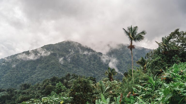
La Soufrière Volcano, the highest peak in Guadeloupe, rises majestically to 1,467 meters and is a must-visit for nature enthusiasts and adventure seekers. This active volcano, known for its fumaroles and sulfur springs, offers a unique glimpse into the geological processes that shape the Caribbean landscape. Visitors can embark on a challenging hike to the summit, where they are rewarded with breathtaking panoramic views of the surrounding islands and lush rainforests. The trail, which is well-marked, takes you through diverse ecosystems, showcasing the rich flora and fauna of the region. As you ascend, the changing landscapes provide a captivating backdrop, making the journey as enjoyable as the destination itself.
La Soufrière holds significant cultural and historical importance, having been revered by the indigenous peoples of the Caribbean. Its eruptions have shaped the island's history, with the most recent significant activity occurring in 1976, prompting the evacuation of nearby communities. Today, the volcano is closely monitored, ensuring the safety of visitors while allowing them to appreciate its natural beauty.
Continue reading the travel guide
Travel Guide to La Soufrière Volcano
When planning your visit, consider the weather conditions, as the best time to hike is during the dry season from December to April. Be sure to bring plenty of water, wear sturdy hiking shoes, and prepare for changing weather at higher elevations. Whether you're a seasoned hiker or a casual explorer, La Soufrière Volcano offers an unforgettable experience in the heart of Guadeloupe.
Why Visit?
Visiting La Soufrière Volcano is an exhilarating experience that combines adventure, stunning natural beauty, and a touch of history. The challenging hike rewards you with breathtaking views and a unique opportunity to witness an active volcano up close.
Best Time to Visit
The ideal time to visit La Soufrière is during the dry season from December to April, when the weather is more stable and suitable for hiking. Early morning is the best time to start your hike to avoid the heat and enjoy clearer views.
Ready to go? Plan your La Soufrière Volcano trip → Good to know →
Plan your trip to La Soufrière Volcano
Flights, accommodation and ways to get around — plan the details that matter to you.
Find flights to La Soufrière Volcano
Nearest recommended airport search point: PTP.
See recent flight offersTo Pointe-a-pitre €397From Pointe-a-pitre €534
Recent flight offers
Compare available fares and routes for La Soufrière Volcano.
Flights to Pointe-a-pitre Arrivals · PTP
Cheap Flights to Pointe-a-pitre for La Soufrière Volcano (PTP)
Compare recent fares to Pointe-a-pitre, the suggested airport search point for visiting La Soufrière Volcano. Choose a listed deal or use the search box above to check prices from your airport.
Flights from La Soufrière Volcano Departures · PTP
Cheap Flights from Pointe-a-pitre (PTP)
Compare the latest low fares from Pointe-a-pitre to popular destinations. Prices are updated regularly and may change based on travel dates and availability.
Stay & getting around
Choose a neighbourhood, then decide how you will get from the airport and around the city.
Where to stay Neighbourhoods and accommodation
Where to Stay in La Soufrière Volcano
The nearest town for accommodation is Basse-Terre, which offers various lodging options from hotels to guesthouses. Staying here provides easy access to the volcano and other attractions in Guadeloupe.
Getting around Airport transfers and local transport

Getting Around La Soufrière Volcano
To reach La Soufrière Volcano, visitors typically fly into Pointe-à-Pitre International Airport (PTP) and then drive or take a taxi to the trailhead. Once in the area, a rental car is recommended for exploring the surrounding natural parks and attractions.
Travel essentials
 Stay connected
 Flight delayed or cancelled?
Popular Activities in La Soufrière Volcano
Good to know about La Soufrière Volcano
Map & DirectionsChoose a map
Open La Soufrière Volcano in your preferred map app.


Country factsCapital, language and useful details
Quick Facts
Country
Location
Practical Information
Climate
Guadeloupe has a tropical climate, characterized by warm temperatures year-round and a wet season from June to November. The dry season, from December to April, is the most favorable time for travel, offering sunny days and lower humidity.
Money
The local currency is EUR - Euro (€). Cards are accepted in many places, but carrying some cash can be useful for small purchases, local transport, and rural areas.
Internet & SIM
Mobile coverage is generally good across Guadeloupe, with several providers offering SIM and eSIM options for tourists. Wi-Fi is available in many hotels, cafes, and public areas, making it easy to stay connected.
Electricity
Voltage: 110 / 120 V
Frequency: 60 Hz
Safety
Emergency
911
Explore more in Guadeloupe
Places to Visit in Guadeloupe

Cities in Guadeloupe
About NomadRoute
NomadRoute helps travelers discover destinations, compare flight options, and find competitive fares from trusted airlines and travel providers worldwide. We do not sell airline tickets directly. Instead, we connect travelers with leading booking partners.
Discover More Destinations
Find low fares from trusted travel providers.
Compare options and book directly with partners.
Explore destinations and routes worldwide.